|
User Guide — iPhone & Apple Watch
|
||
|
|
|
MetrO is your free smartphone guide for navigating public transport worldwide. The app covers more than 400 cities — metros, trams, suburban rail, buses, VAL, funiculars — and calculates your routes entirely offline, without an Internet connection, directly on your iPhone.
Available on the App Store, MetrO has been developed by Patrice Bernard & Frank Van Caenegem (Kinevia) since 1997.
MetrO is free. In return, we count on your help to report changes in your transport network via the Send Comments feature.
This guide describes the features of the iPhone version and the Apple Watch companion app.
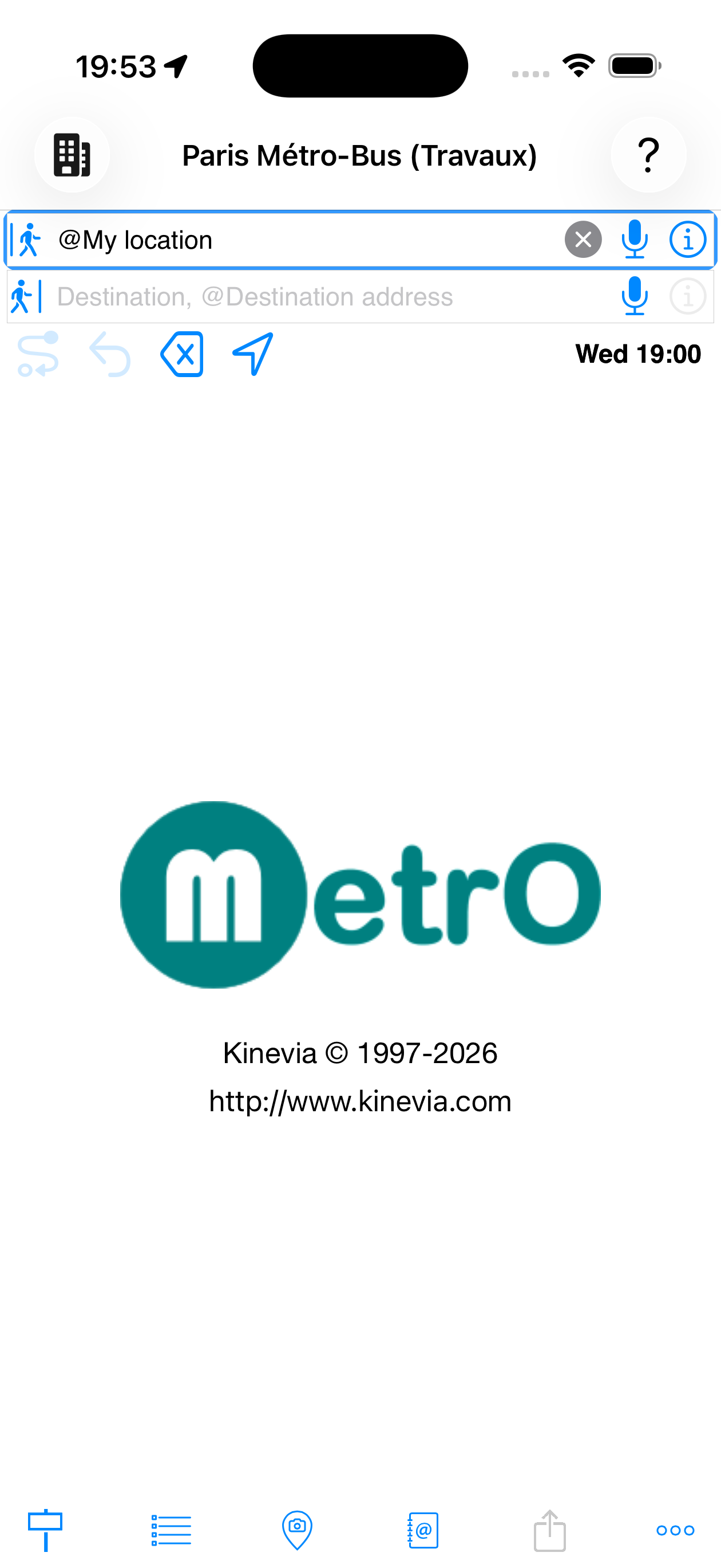
Interface — The main screen includes:
- Two input fields:
 departure and
  arrival
 - A toolbar for refining the calculation:
 Calculate ·
 Reverse ·
 Clear ·
 My location ·
Schedule
My location ·
Schedule - A tab bar at the bottom:
 Stations ·
 Lines ·
 POI ·
POI ·
 Share ·
 Preferences
Before planning a route, select the city you want to travel in. Tap the
![]() icon at the top left
to open the list of available cities.
icon at the top left
to open the list of available cities.
- Installed cities show a
 trash icon
 - Cities whose location is near your phone (≈ 50 km) appear in blue
- Cities available for download show a

- An alphabetical search bar on the right side provides quick access
- Tap "Get Cities" to download new data (connection required)
Once a city is selected, all searches apply exclusively to its transport network.
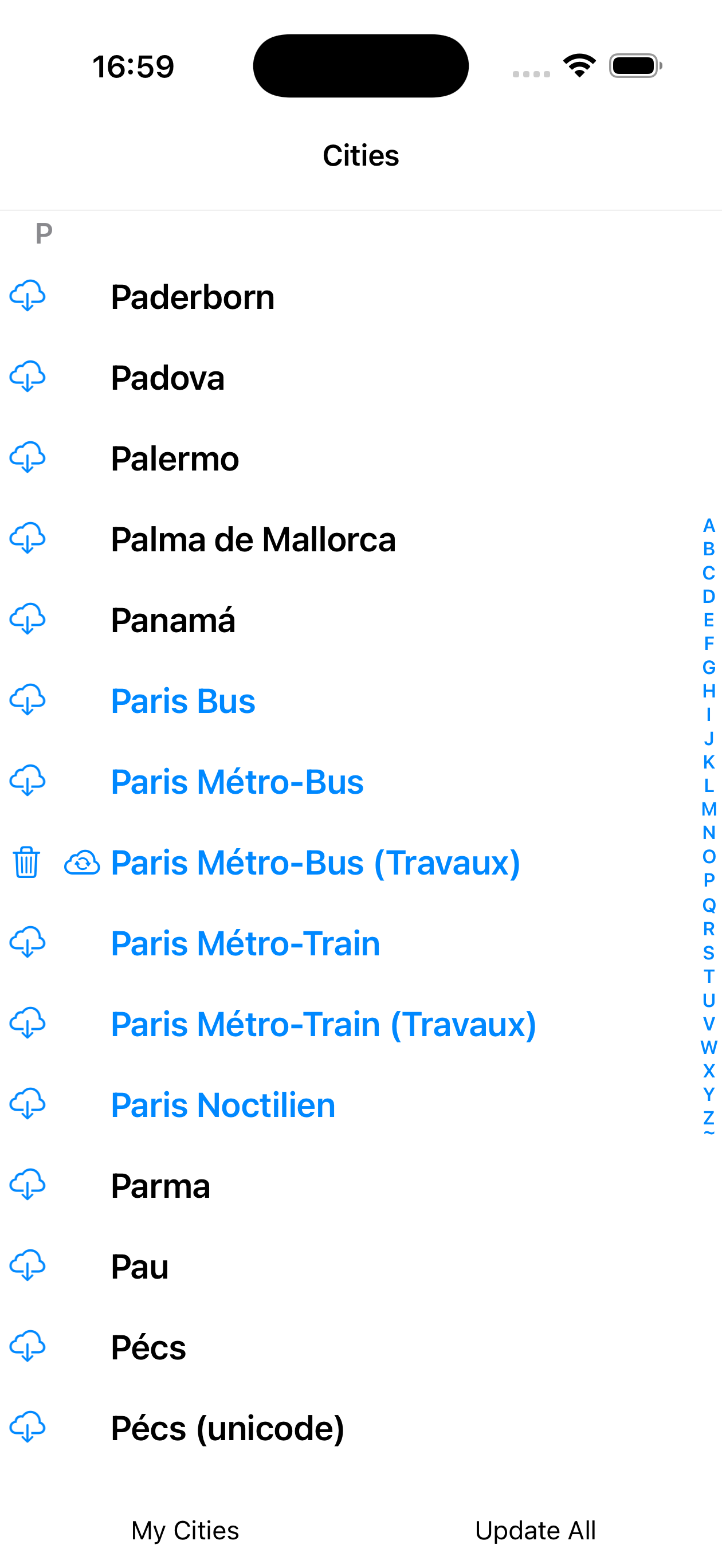
cities
City colour coding
| Display | Meaning |
|---|---|
| Name in blue | City whose GPS location is near your current position — MetrO suggests it first |
| Name in grey | Data is too old — update recommended |
| City installed locally — can be deleted to free up space | |
| Update available for an already installed city | |
| City available to download (not yet installed) |
1. Enter departure and arrival
Tap the ![]() departure field and type the first letters. MetrO instantly shows matching suggestions. Do the same for the
departure field and type the first letters. MetrO instantly shows matching suggestions. Do the same for the ![]() arrival field.
arrival field.
- Search covers station names, addresses and points of interest
- The
 microphone allows voice input
 - The button swaps departure and arrival and recalculates in the opposite direction
- The
 button clears the active field
 - The
 button opens the detail sheet of the selected station
Tap ![]() to start the calculation.
to start the calculation.
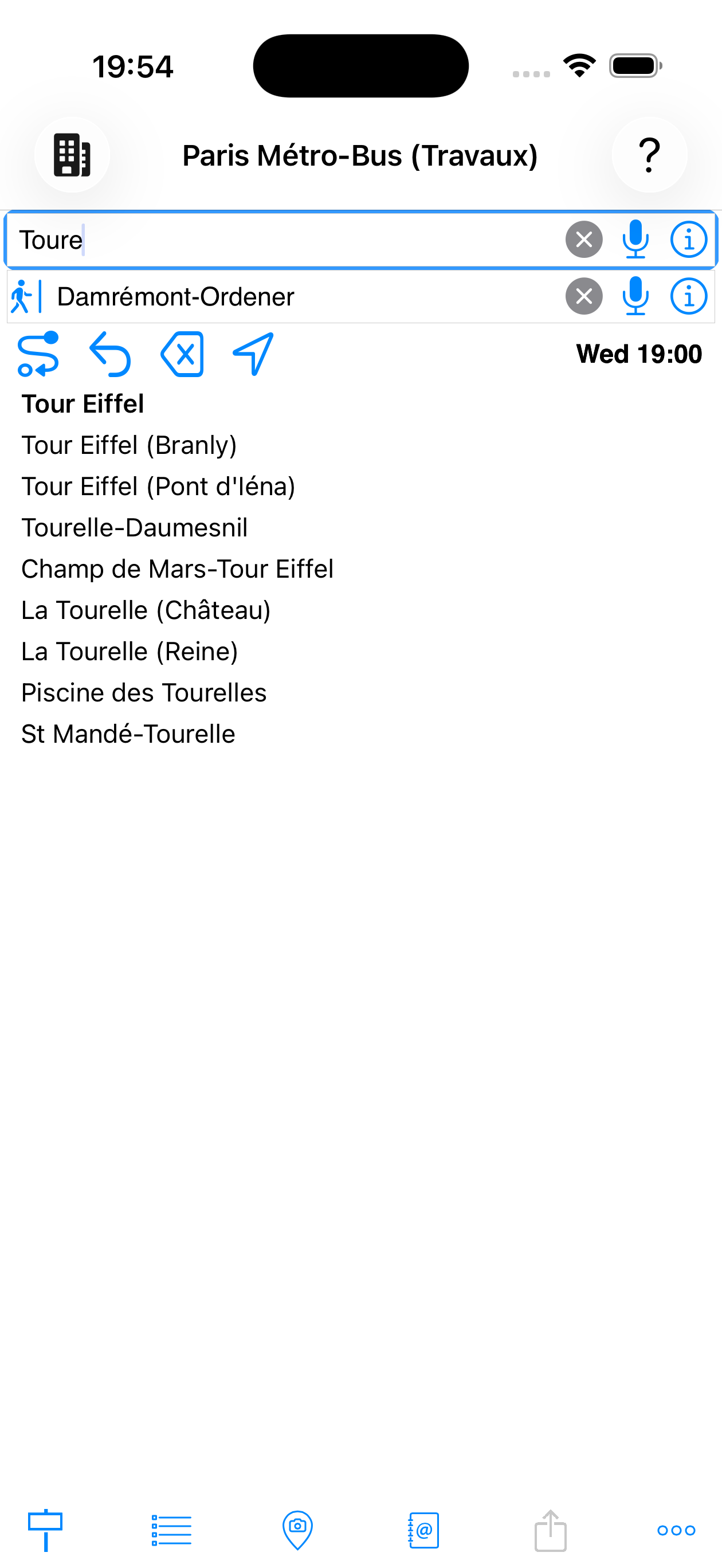
while typing
The toolbar below the input fields contains the calculation buttons, from left to right:
| Button | Function |
|---|---|
| Calculate route — starts the calculation with the current |
|
| Reverse route — swaps departure and arrival and calculates the route in the opposite direction | |
| Clear — resets both fields | |
| My location — uses GPS to fill the active field with your current position | |
| Mon 10:00 | Departure time — tap to choose the desired day and time. MetrO takes into account real network timetables (evening services, Sundays, etc.) |
| ☀ 23°C | Destination weather — appears automatically once data is loaded. Shows the temperature at destination. Tap to open the hourly forecast panel (see Weather & AQI section) |
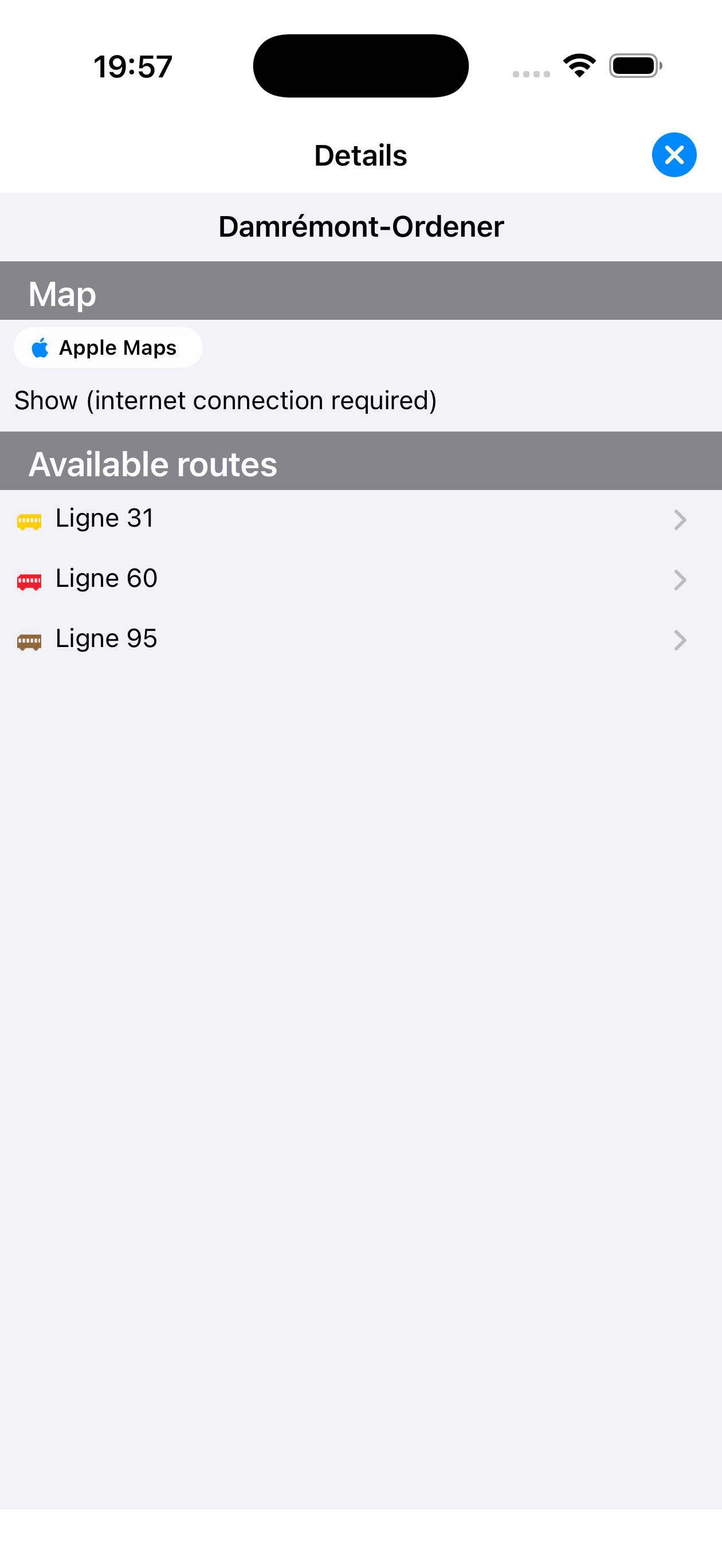
| City info — Shows detailed information about the active city: statistics, update notes, fare conditions, ongoing works warnings |
City Info page
The City Info page shows:
- City name and last update date
- Statistics: number of lines, stops, favourites
- Release notes, fare conditions and works warnings
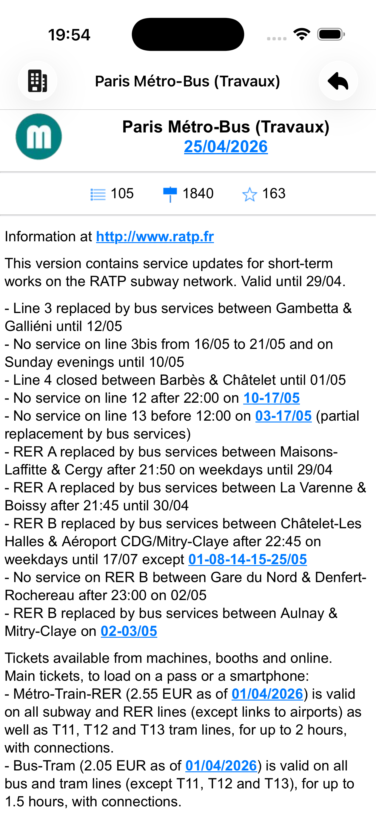
Paris Métro-Bus
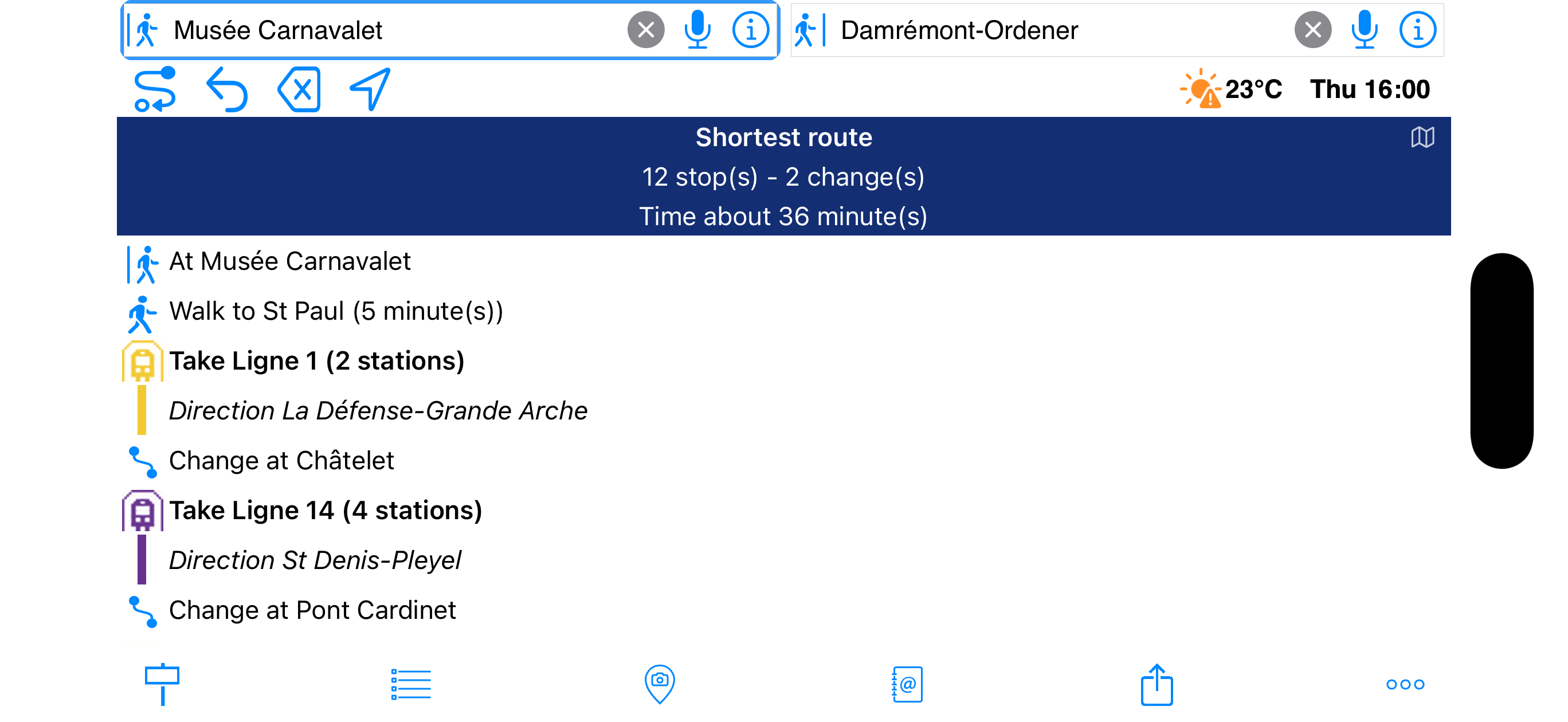
2. Reading the results
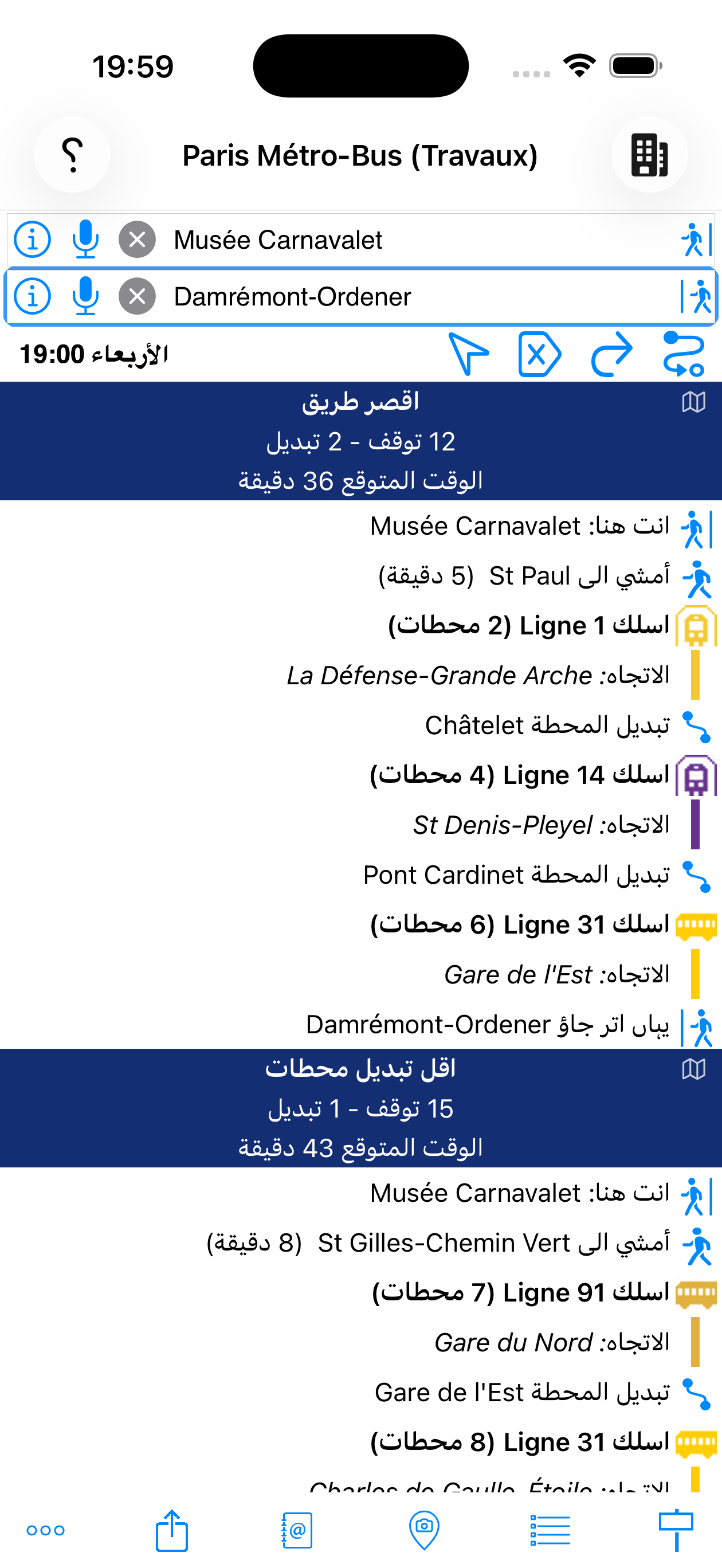
MetrO calculates and displays several routes simultaneously:
- Dark blue banner — summary: number of stops, transfers and estimated duration
- Walking steps
- Line to take with coloured icon, direction and number of stations
- Transfer
- Get off at
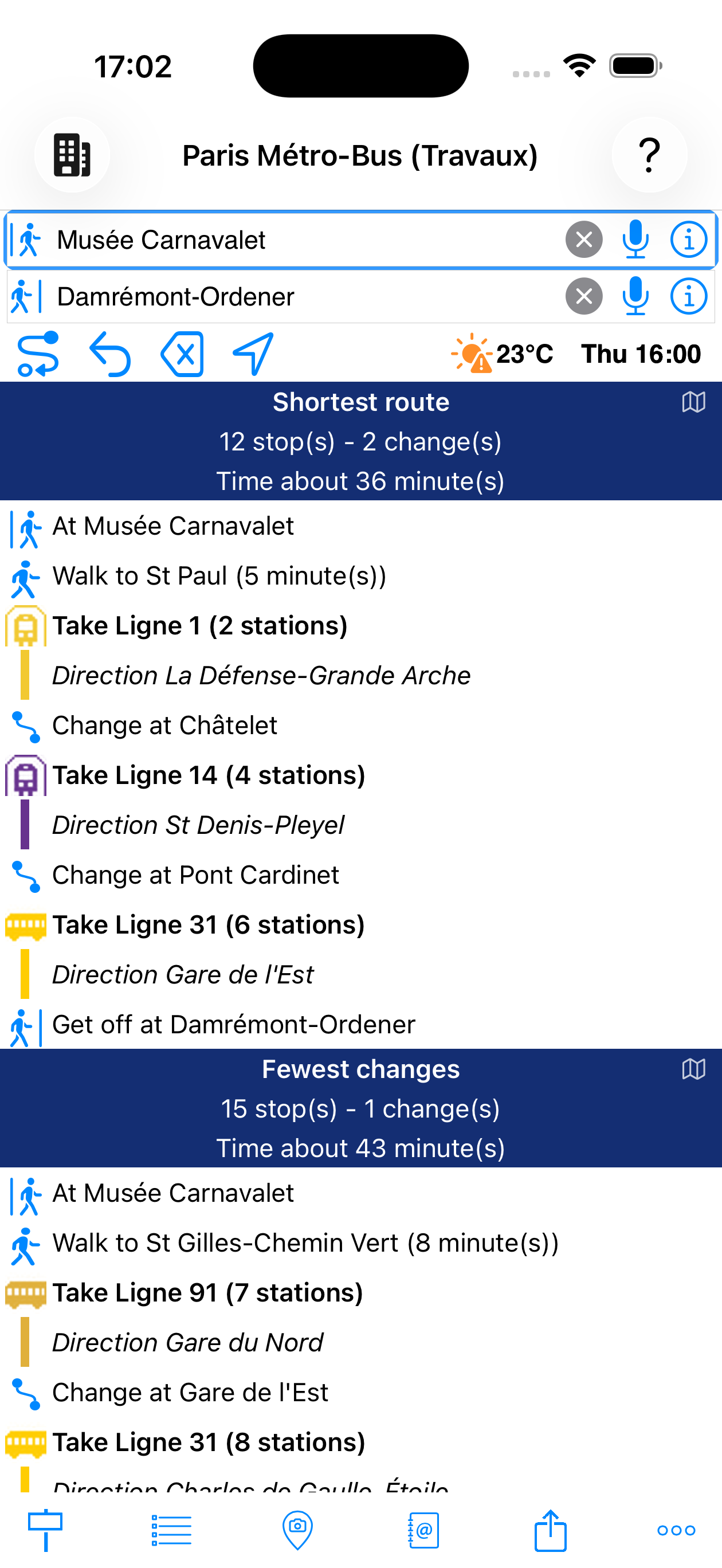
calculated
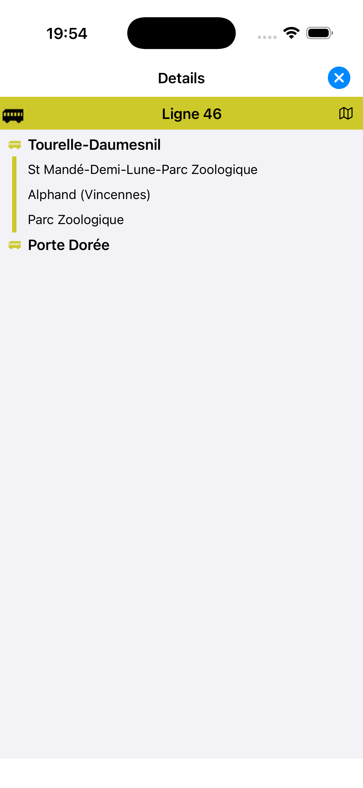
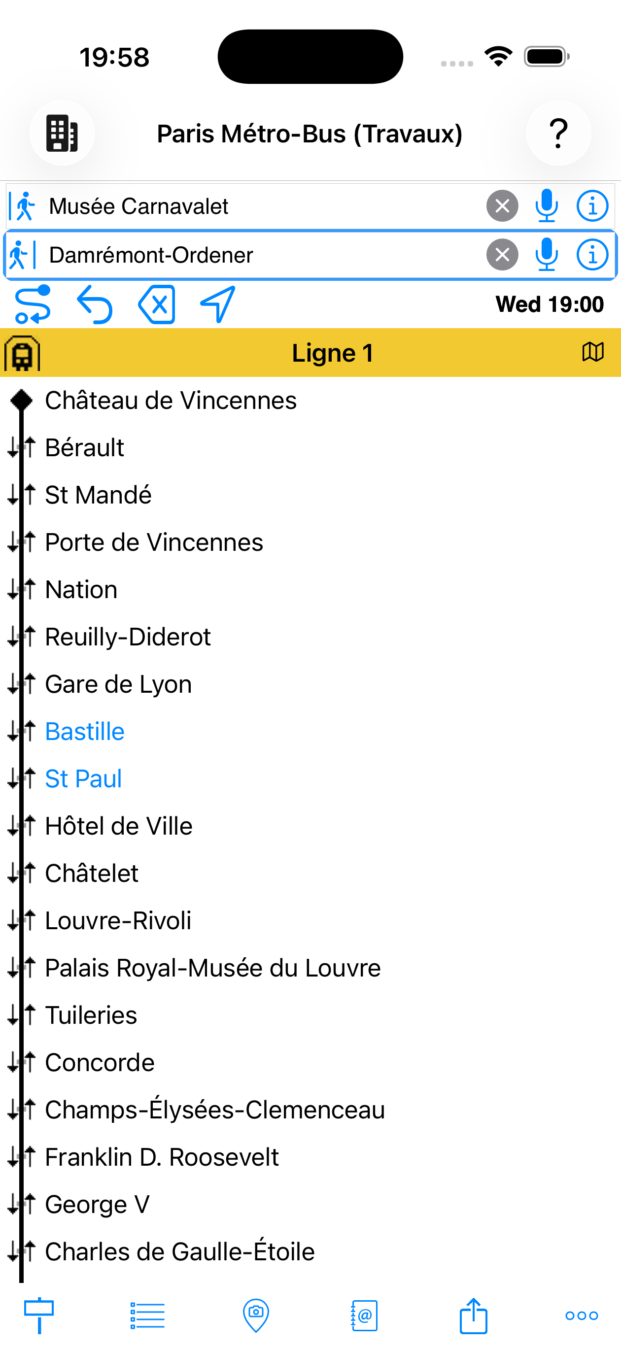
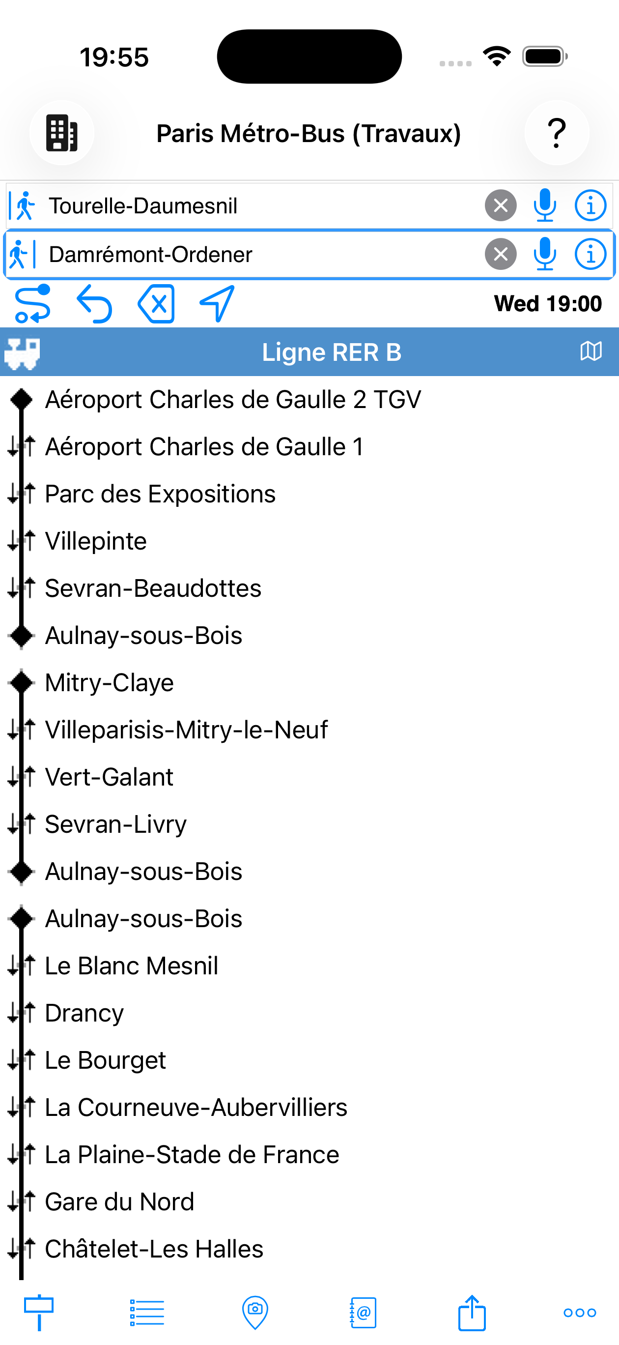
3. View stops on a line
Tap a line in the results to display the full list of its stops in the direction taken.
from results
Beyond station names, MetrO accepts several types of sources for the ![]() departure and
departure and ![]() arrival fields:
arrival fields:
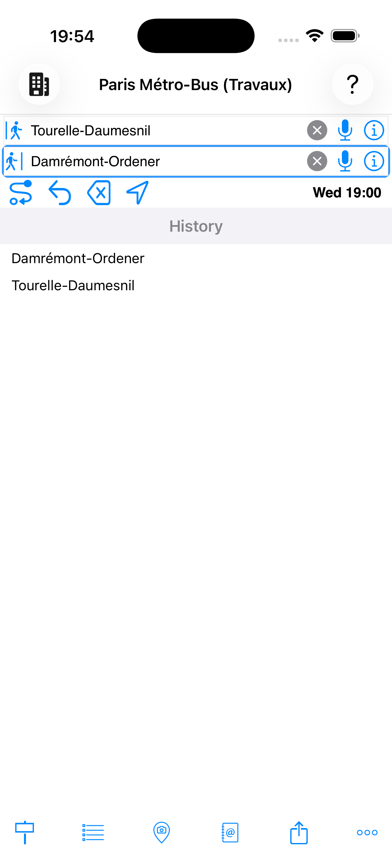
Recent entries are suggested as soon as the field is activated
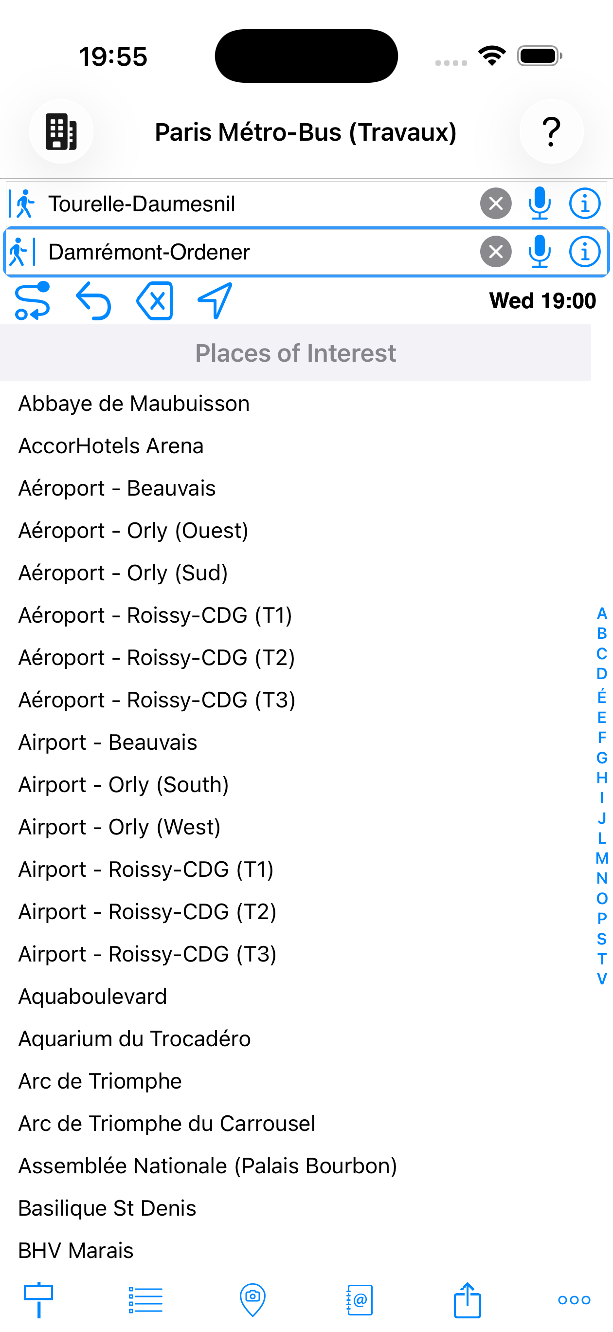
Museums, stations, airports, shopping centres…
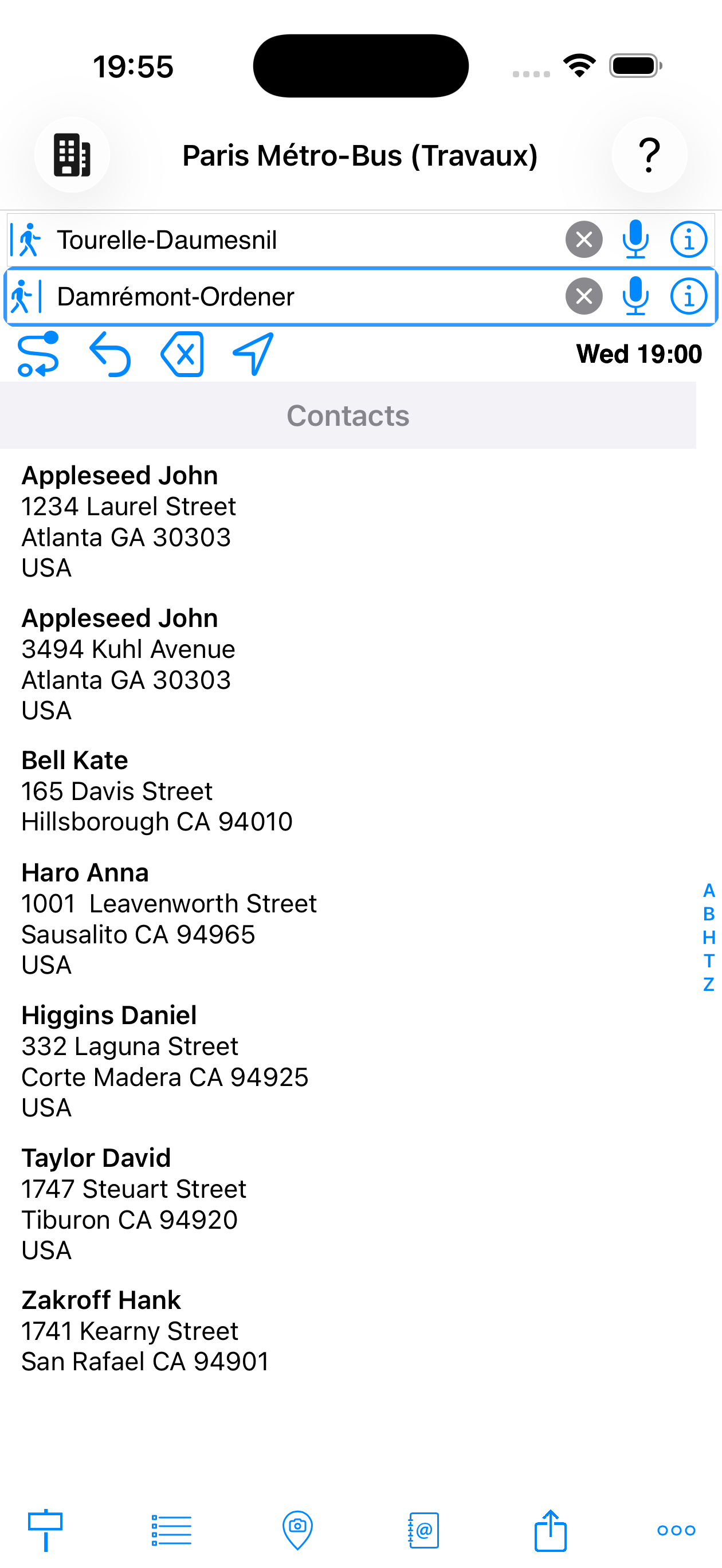
Addresses from your iOS contacts
Other input modes:
- My location — "@My location" uses your GPS position as the departure point
- Stations tab — alternately shows the full alphabetical list of stations in the city or the recent search history
- POI tab — points of interest
MetrO will automatically find the nearest station to the selected location.
Home and Work
If your personal contact card (your own entry in iOS Contacts) contains a Home or Work address, MetrO automatically suggests them as Home and Work in the input suggestions — with no additional setup required.
You can also type these aliases directly into an input field:
- Home — accepted aliases:
@Home·@Residence - Work — accepted aliases:
@Work·@Office
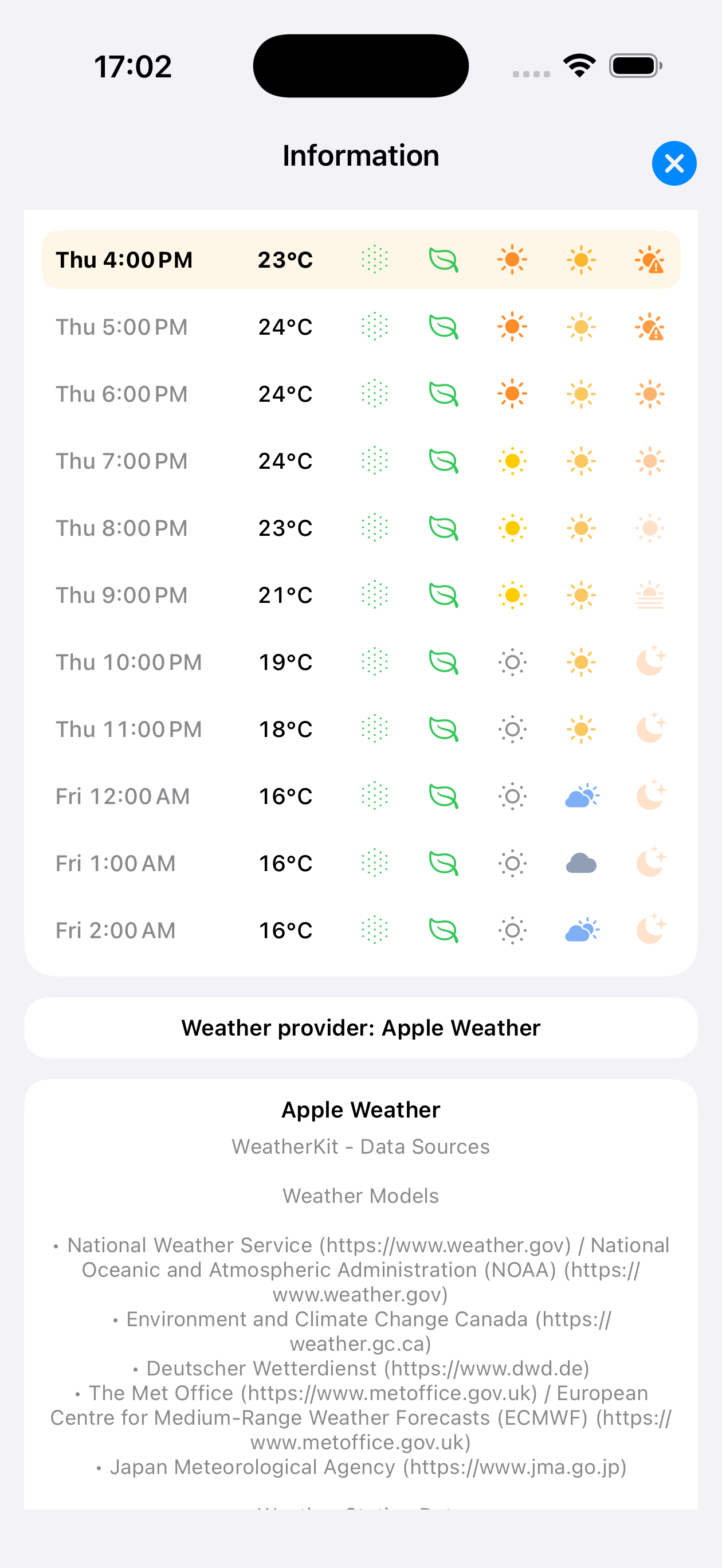
When MetrO has the GPS coordinates of the destination and an Internet connection, a weather button appears automatically next to the timetable button in the toolbar. It shows the current temperature at the destination along with a condition icon (sun, clouds, rain…).
Tapping this button opens an hourly forecast panel for the coming days. Each hour shows:
- 🌡 Temperature — in degrees Celsius
- ☀ Sunshine — solar irradiation intensity
- 🍃 AQI (Air Quality Index, US scale) — air quality: 0–50 good, 51–100 moderate, 101–150 unhealthy for sensitive groups, >150 unhealthy
- 🌿 Pollen — pollen level (grass)
- ☀ UV — ultraviolet index
- Weather condition icon — clear, cloudy, rain, snow…
The hour matching your departure time is highlighted in the panel. Data is provided by Apple Weather or Open-Meteo depending on availability.
weather, AQI, pollen
Tap a step → Station detail
In the results, tapping any step (board a line, transfer, walk, alight) opens the station detail sheet:
- Location map
- Nearby stops
- All lines serving this stop
- From the sheet, use the station as a new departure or arrival
opened from a result
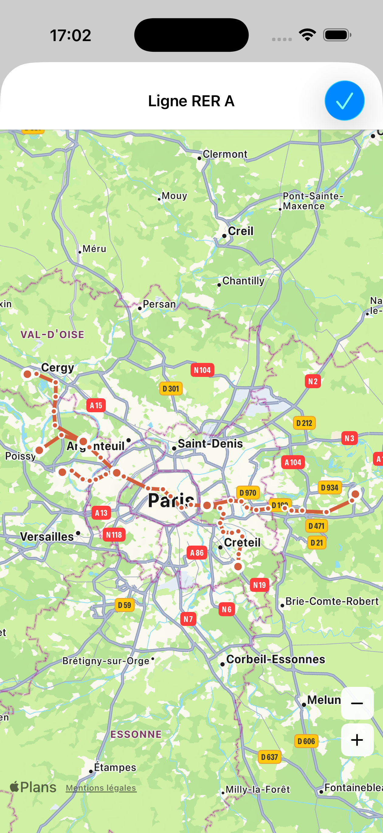
Tap the summary banner → Route map
The blue banner at the top of each route is tappable. A tap shows the full route on a map:
| Element | Meaning |
|---|---|
| ● Green marker | Departure point of the route |
| ● Red marker | Arrival point of the route |
| ● Coloured circle | Intermediate station — in the official colour of the line used |
| Solid coloured line | Transit segment — line colour |
| Grey dashes | Walking segment between two stations |
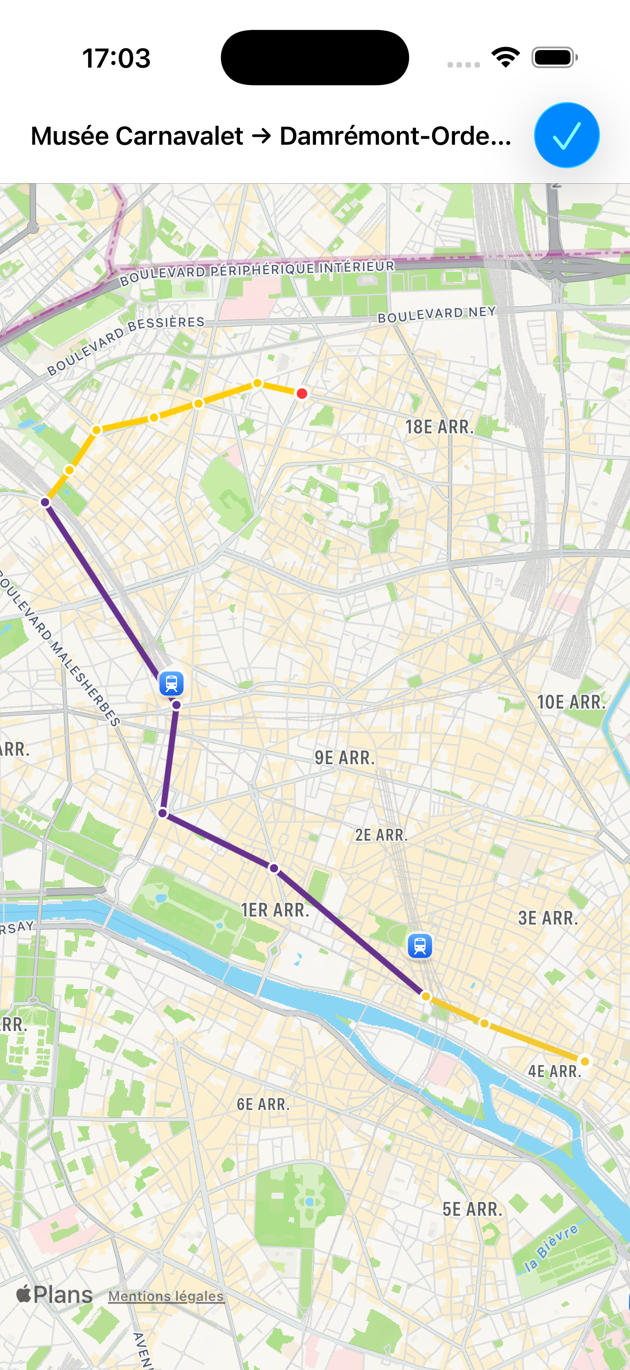
Carnavalet → Damrémont
Tap a stop in a line's list
From the list of stops on a line (obtained by tapping a line segment in the results), tapping a stop places it directly in the active input field (![]() departure or
departure or ![]() arrival).
arrival).
input field
Stop colours in a line's stop list
When viewing the stop list for a line (from results or the Lines tab), stations are colour-coded by role:
| Colour | Meaning |
|---|---|
| Red | Station exactly matching your entered departure or arrival |
| Blue | Station matching the detail sheet you opened, or station geographically close to your departure / arrival |
| Grey | Closed station (marked out of service in the city data) |
| Black | Normal station |
Long presses (hold finger > 1 second)
| Where | Result |
|---|---|
| Summary banner (title or stats line) |
🔊 Voice playback of the full route (Text-to-Speech) in the interface language |
| Walking step | Opens pedestrian directions |
| Stop in a line's stop list | Opens the station's detail sheet |
| Station in the |
Opens the station's detail sheet |
| Place in the |
Opens the place's detail sheet |
| Contact in the contacts list | Opens the contact card in the address book |
Additional gestures
| Gesture | Result |
|---|---|
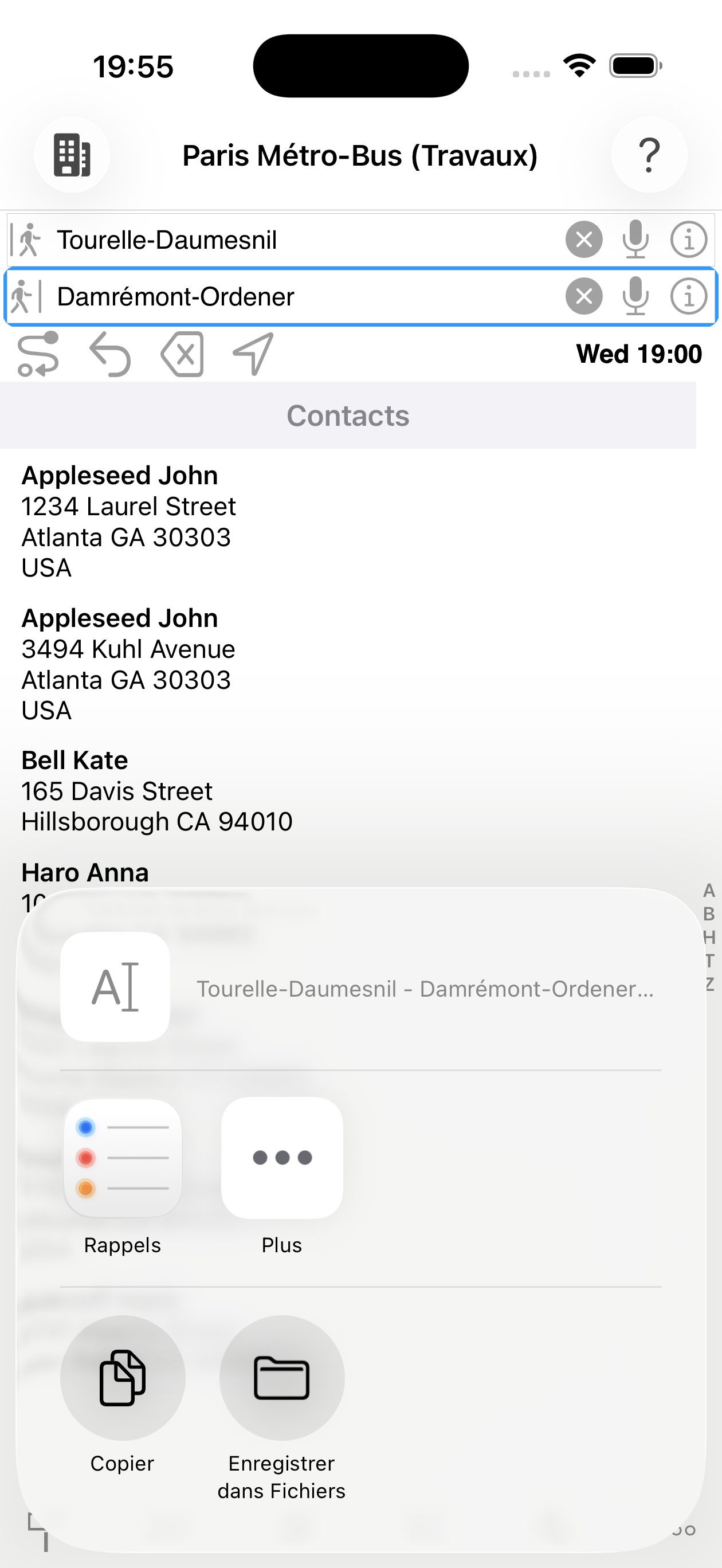
| Opens the iOS share sheet — copy, email, SMS, AirDrop… with the full route text | |
| Shake the phone | Immediately recalculates with the current fields (equivalent to the Go button) |
The ![]() Lines tab (bottom bar) lists all transport groups in the active city. Navigation works on two levels:
Lines tab (bottom bar) lists all transport groups in the active city. Navigation works on two levels:
- Tap a group (Metro, Suburban Rail, Bus…) to see all its lines
- Tap a line to display all its stops in order, with transfers
A map button at the top of the stop list shows the geographical route of the line.
with transfers ↕
Tap the map button from a line's stop list to see its full route.
Filter transport modes
Uncheck an item to exclude it from the calculation.
Example uses:
- Exclude lines under maintenance
- Avoid certain modes for reduced mobility reasons
- Force a route using metro only
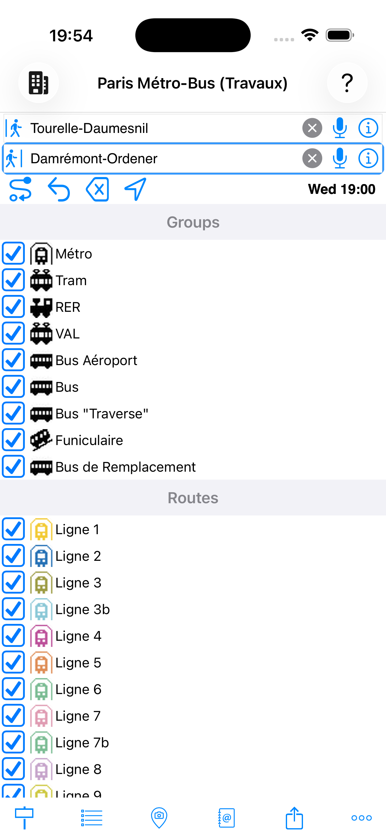
and lines active
Tap a group to expand it and check/uncheck lines individually. The calculation restarts automatically with the new filters when you return to the main screen.
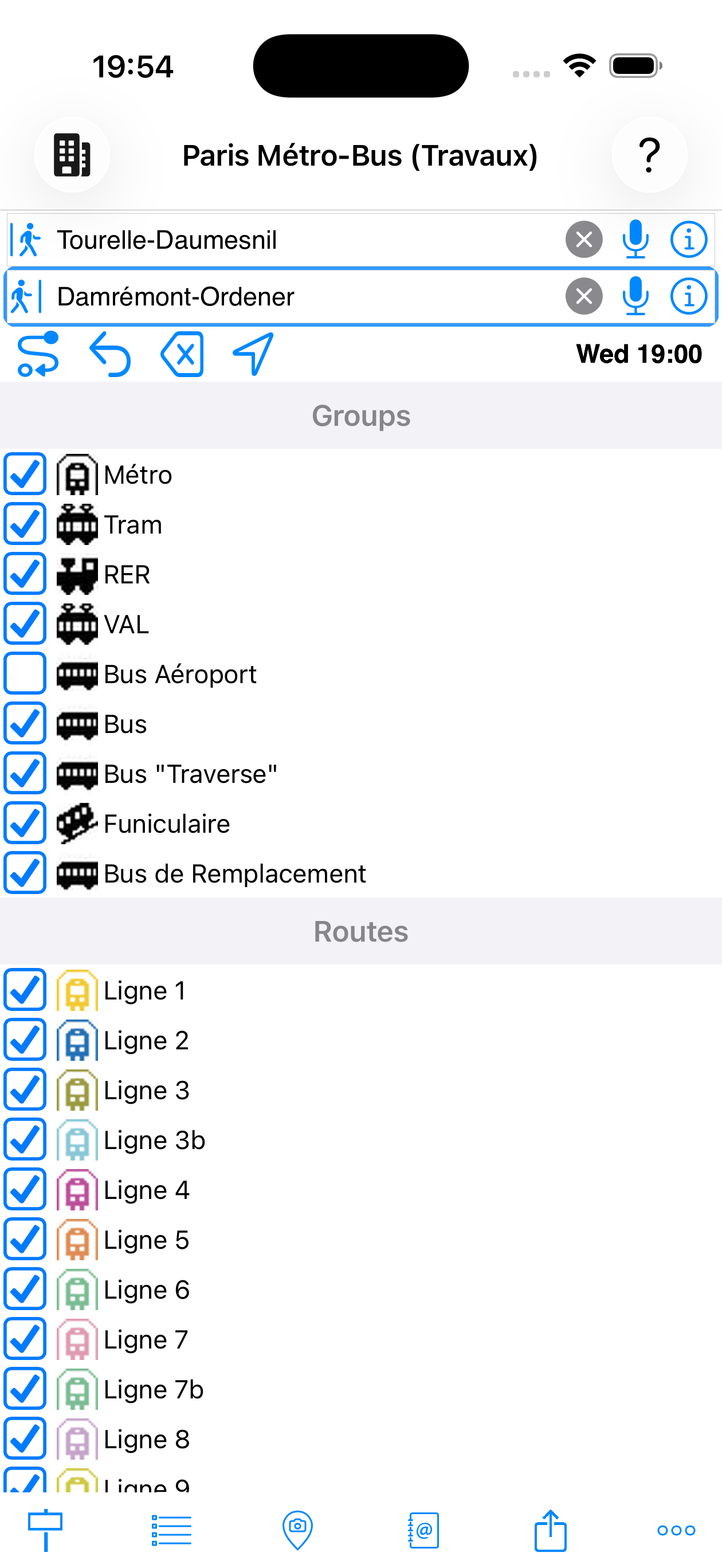
disabled
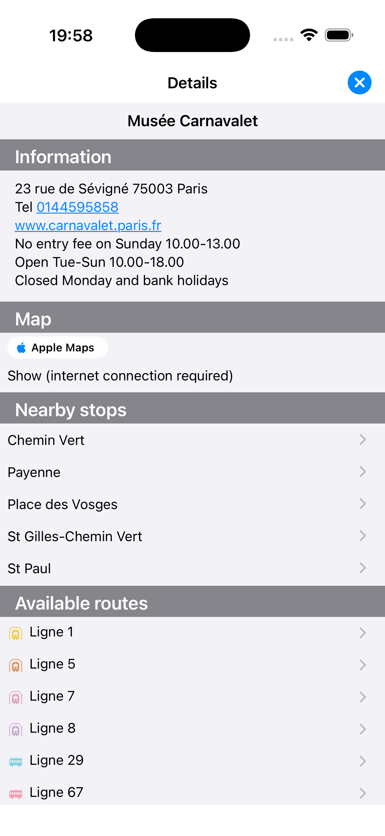
Station detail sheet
Accessible via the ⓘ button next to an input field, or by long-pressing a station. Contains:
- Map — location on a plan
- Nearby stops — stations in the vicinity
- Available lines — with official icon and colour
Tap a line in the sheet to access the full list of its stops.
Map icons in the station sheet
| Marker | Meaning |
|---|---|
| Station or POI being viewed — the place whose sheet you are reading | |
| Nearby stop — station in the vicinity, tap it to see its sheet | |
| Transport point of interest associated with the sheet (stops or POIs linked to the viewed location) |
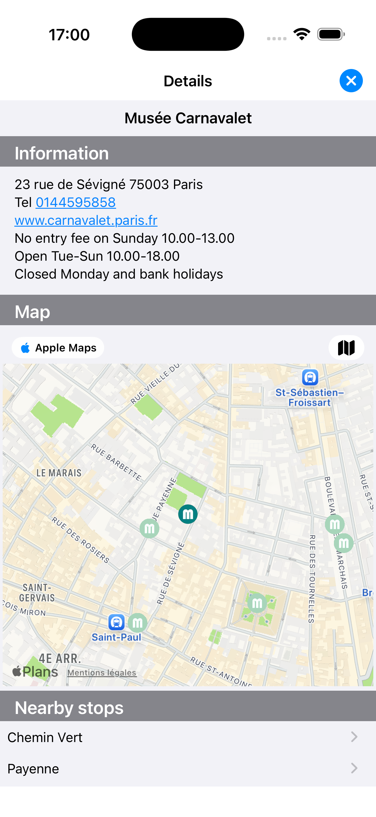
Musée Carnavalet
Point of interest sheet
POI sheets (museums, stations, airports, hotels…) also display practical information: address, phone, website, opening hours, access. Nearby stops and available lines allow you to reach the location directly from your route.
Musée Carnavalet
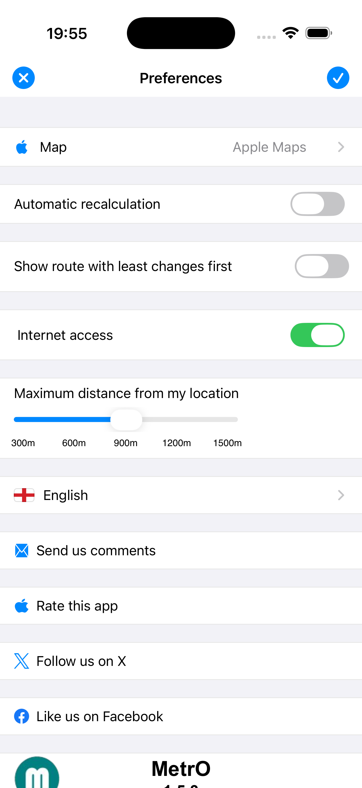
The ![]() Preferences tab (bottom tab bar, far right) contains all app settings:
Preferences tab (bottom tab bar, far right) contains all app settings:
| Setting | Description |
|---|---|
| Map | Apple Maps, Google Maps, Bing, OpenStreetMap, MapLibre, OpenRouteService |
| Automatic recalculation | When departure is set to My location, automatically recalculates the route once you have moved more than 100 metres since the last calculation |
| Fewest changes first | Prioritises comfort over speed |
| Internet access | When disabled, MetrO works entirely offline: city downloads and updates are blocked, maps in detail sheets are disabled, weather is unavailable. Useful to control mobile data usage |
| Max distance (GPS) | Search radius for nearby stops (300 m to 1,500 m) |
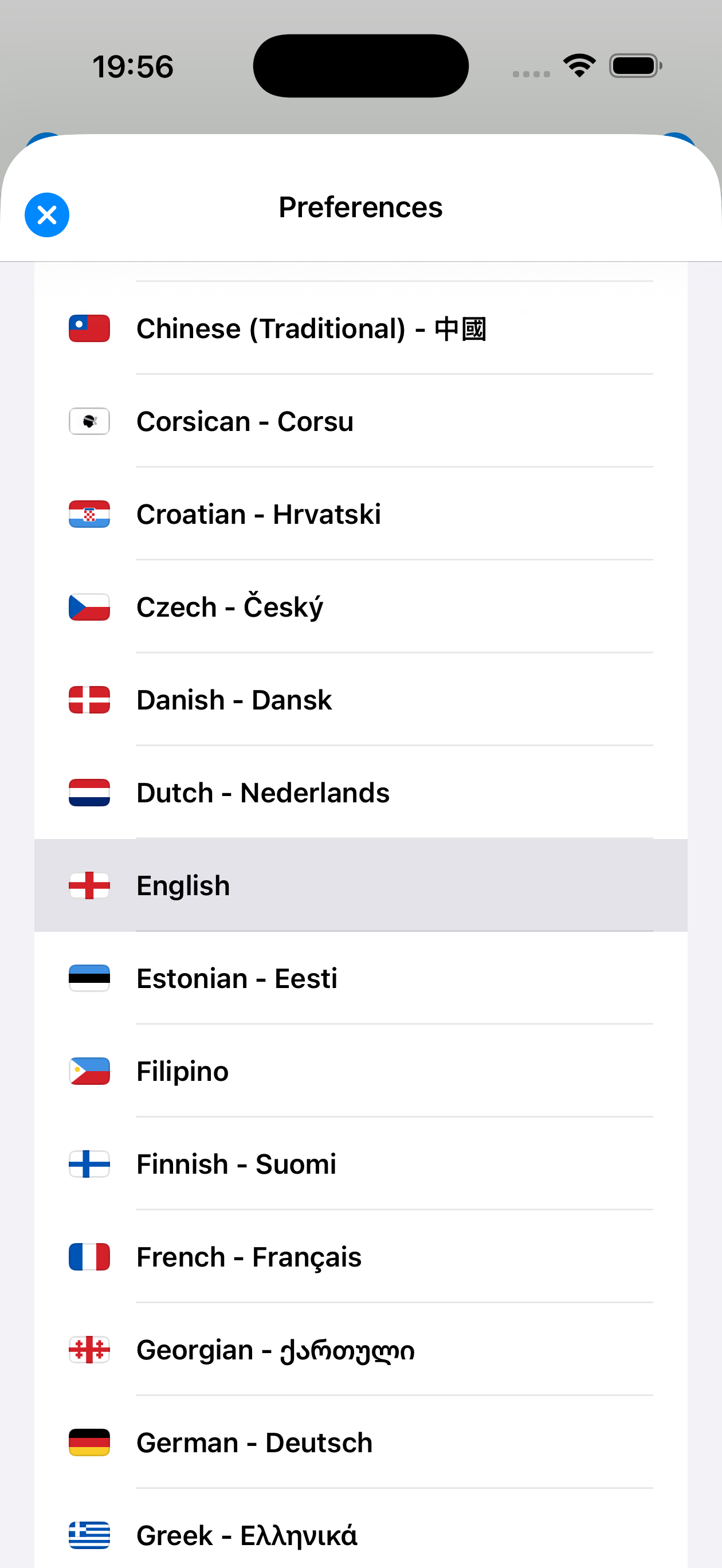
| Language | Interface available in +50 languages (including Arabic, Hebrew, RTL) |
| Send comments | Report an error or network change to the authors |
| Rate the app | Opens MetrO's App Store page to leave a review |
| Twitter / X | Follow MetrO news on X (formerly Twitter) |
| MetrO's Facebook page |
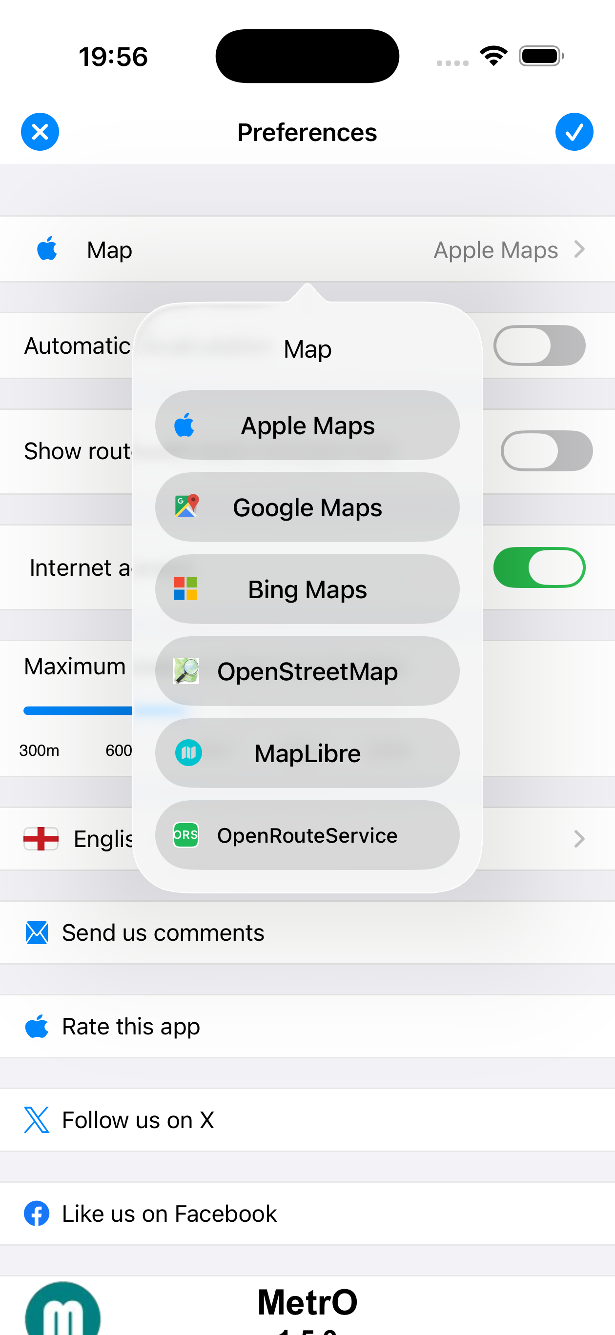
6 mapping providers available
Multilingual interface, RTL support
MetrO automatically adapts to landscape orientation: the input fields move side by side and the tab bar shifts to the edge of the screen to maximise the space available for results.
Right-to-left writing scripts (Arabic, Hebrew…) are natively supported: the entire interface mirrors when you select the corresponding language in Preferences → Language. Both modes can be combined.
Lock screen notification
MetrO can display a persistent notification on your lock screen during navigation. It shows:
- The next step to take (walk or board a line)
- The estimated remaining time
- The direction and number of stations
Tap the notification to return directly to the current route.
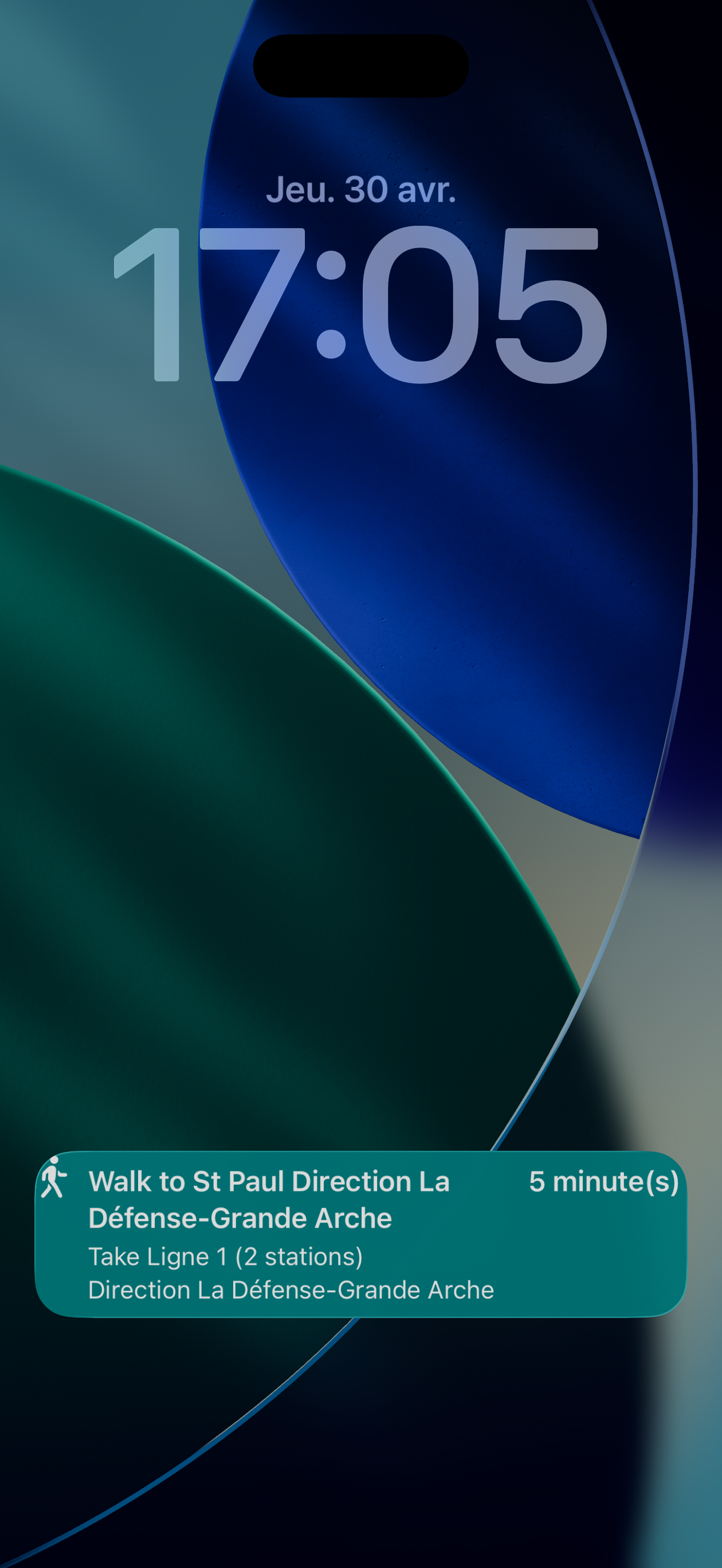
on lock screen
Spotlight search
MetrO integrates with iOS Spotlight search. From the home screen, swipe down and type the name of a station or place: MetrO directly suggests matching results. Tap a result to open the app with the station pre-filled.
"tour eiffel"
Icon shortcuts
A long press on the MetrO icon shows quick shortcuts:
- Go home — places your home address (from your contact card) directly in the arrival field
- Go to work — places your work address in the arrival field
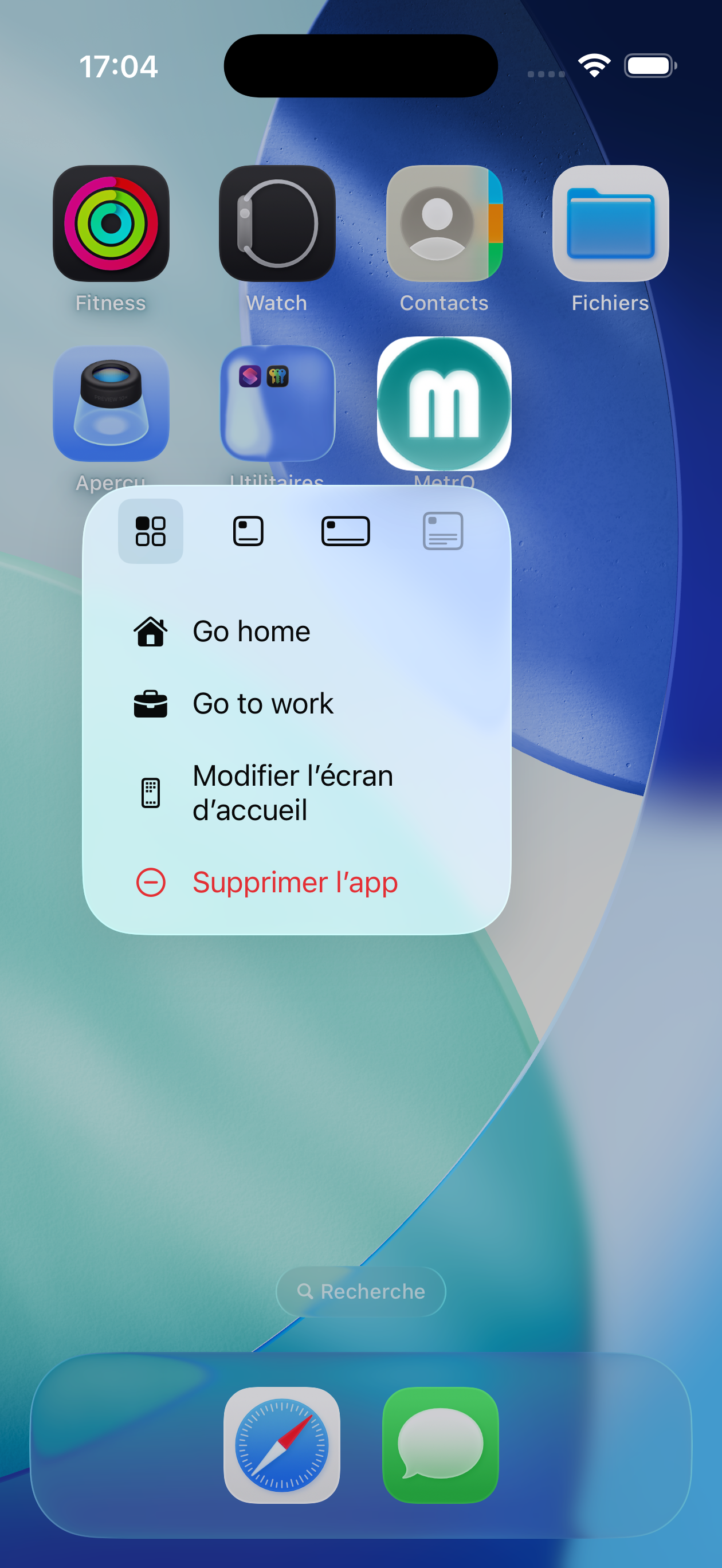
long press on icon
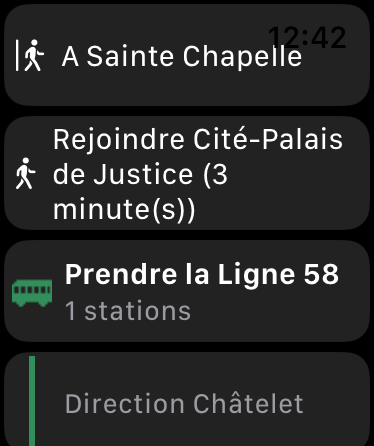
MetrO includes an Apple Watch companion app that displays your current route directly on your wrist.
As soon as a route is calculated on iPhone, it is automatically transmitted to the Watch:
- Lines to take — with coloured icon and number of stations
- Transfers and alighting stops
- Walking transfers with estimated duration
- Line direction shown as subtitle
If the Watch has not yet received the data, it automatically requests it from the iPhone as soon as the Bluetooth connection is available. Open MetrO on your Watch: the route appears within seconds.
Complication — MetrO can display the current route summary directly on your watch face.
Apple Watch
- Select your city by tapping its name at the top of the screen before entering a route.
- Type just a few letters — autocomplete does the rest.
- Use the History field to quickly relaunch a recent trip without retyping.
- During strikes or engineering works, disable the affected lines (
 Filters) to get an alternative route.
 - Tap the blue banner on a result to view the route on the map.
- Shake the phone to recalculate with the current departure/ arrival fields.
- Use Share to send the route by SMS, email or AirDrop to your travel companion.
| Copyright © 1997–2026 Kinevia SARL. All rights reserved. Last update on 01/05/2026 |
MetrO… |